Council advocacy aims to improve BoM flood data in Texas and Goondiwindi Region
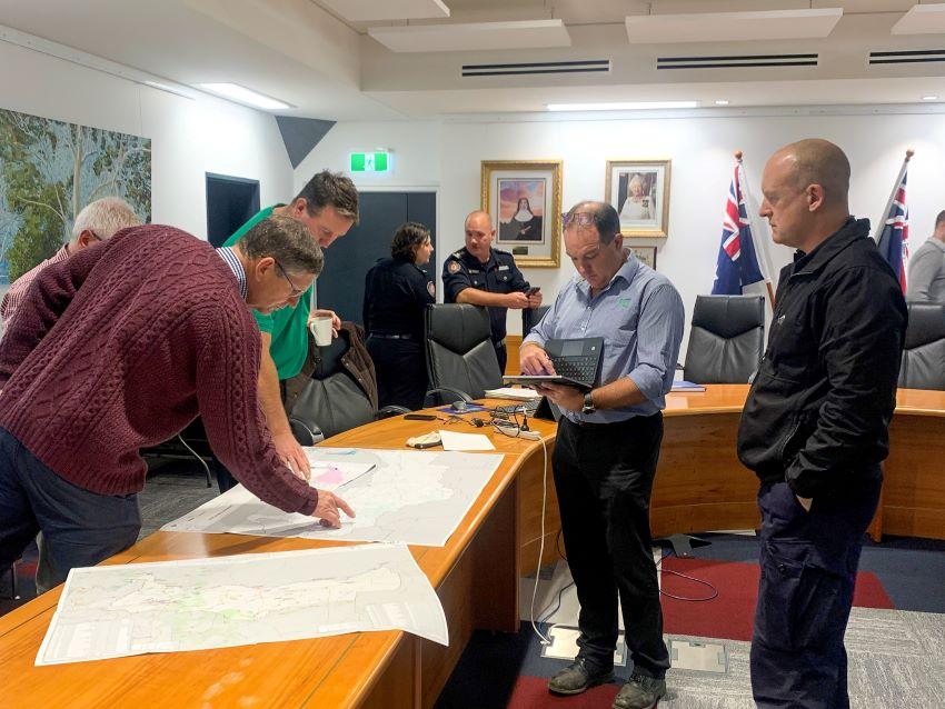
« BackContinued advocacy by Goondiwindi Regional Council on behalf of flood-affected Texas landholders has resulted in a visit to the town by the Bureau of Meteorology (BoM) and the Queensland Reconstruction Authority (QRA) to address concerns about access to accurate and timely information during flood events.
The BoM met with affected landholders on Thursday last week to hear residents’ feedback and look for opportunities to improve local flood gauging, modelling, and warnings. The BoM, along with QRA’s Resilience Projects Manager Greg Scroope also met with Council in Goondiwindi on Friday to discuss the potential placement of additional river gauges across the Goondiwindi Region, particularly in the east.
Council committed to pursuing residents’ concerns about insufficient communication of flood warnings following major flooding in the Texas area and upstream in March 2021. Local residents also reported that they were unable to access current BoM river height updates as the flooding unfolded.
Cr Rick Kearney holds Council’s portfolio for Local Disaster Management and attended the BoM workshop with local landholders and councillors. He said the focus of the day was to develop a plan of action for improved access to information.
“During a flood event, river height data and warning systems need to be fast and accurate,” Cr Kearney said. “Especially in the headwaters around the east and upstream of Texas in particular, the water can come really fast. There’s not much time to make decisions,” he said.
“Unfortunately, during the March 21 flood event in Texas, some farmers were relying on that important BoM data to make decisions about whether or when to move livestock and infrastructure. That data turned out not to be correct, and the resulting losses were significant.
“People’s lives and livelihoods depend on the accuracy of that data,” he said. “I want to thank the BoM for this visit to the Goondiwindi Region and for their willingness to listen to local concerns and commitment to reviewing the current modelling as a priority.”
Local resident Bob South lives upstream near to where the streams flow together. He attended the Thursday meeting with the BoM and said the accuracy of information was essential.
“All the catchment river information with regards to volume and peak times needs to be available on the one site, regardless of state – and [we need] to know it is accurate,” Mr South said. “I add three or four rivers together, so I need to know volumes.”
The information that Mr South gathers is also considered essential to those who live downstream, such as Dan Ostwald who farms near Beebo.
“We need standardisation and uniformity between the gauges in regards to flow and height,” Mr Ostwald said. “It makes sense for all gauges to be controlled by the one body with a central point to access that information.”
Mayor of the Goondiwindi Region the Honourable Cr Lawrence Springborg AM said Council initiated communication with the BoM as a matter of urgency after the flood event last year. While the BoM was quick to respond, the resulting visit to Texas was delayed for more than 12 months due to further local flood events and the COVID-19 pandemic.
In preparation for last week’s visit, Council approached and encouraged landholders along the Dumaresq River to attend the workshop prepared with examples of the impact of incorrect river gauge readings – and suggestions about the data they’d need during future flood events.
“In this age of modern technology, we can achieve solutions that are timely and accurate,” Cr Springborg said. “Ultimately, landholders rely on flood gauging and modelling to inform how they manage a flood on their property - and in this instance, they were let down by bad information,” he said.
“I understand that this data shortage was also raised as a concern following the 2011 floods in our region, and it is extremely disappointing to learn that it had not been rectified in 2021,” he said.
The BoM does not own or install river gauges and instead relies on information from as many as 60 different owners across the state. In the Goondiwindi Region, the network is privately owned by at least six different agencies such as SunWater or WaterNSW.
Cr Springborg said Council is continuing to advocate for greater consistency in river gauge calibration and ownership.
“We need better collaboration [between states and sites], standardised gauges where everyone has confidence, gauges that are fit for purpose and a single point of truth to read the data,” he said. “Time is of the essence here; after big rain events, some farmers have half an hour just below where the rivers meet and others have hours at the most before they see the water. The water moves fast and decisions need to be made quickly.”
“While it’s great to see an action plan developed for Texas, I want to emphasise that this issue affects the whole region,” Cr Kearney said. “We’ve seen how incorrect river gauges can cause problems in other areas of the region, and are also very aware of the need for more information in some places, such as the creeks up from Coolmunda.
“Put simply - how can you predict how much water will come out from the dam if you don’t measure what’s going into it? That information is essential.”